Key Points
- Scafell Pike is England’s highest mountain at 978 meters, located in the Lake District, with several walking trails to the summit, each varying in length and difficulty.
- The most popular routes include Wasdale Head (8.6 km, 4-6 hours), Corridor Route from Seathwaite (17 km, 6-8 hours), Langdale (19 km, 7-9 hours), and Eskdale (15-20 km, 6-8 hours), suitable for different fitness levels.
- This can be a challenging hike requiring preparation, with stunning views and wildlife, though there’s a minor controversy over trail lengths, with official data supporting these estimates.
- Practical tips include checking weather, wearing sturdy boots, and booking accommodation in advance, especially during peak season.
Introduction to Scafell Pike
Scafell Pike, standing at 978 meters (3,209 feet), is England’s highest mountain and a crown jewel of the Lake District National Park in Cumbria. This iconic peak attracts thousands of hikers annually, drawn by its challenging trails, breathtaking views, and the sense of accomplishment that comes with reaching the summit. Whether you’re an experienced mountaineer or a casual walker, Scafell Pike offers a range of routes to suit different fitness levels and preferences, making it a must-visit for adventure seekers.
Route Options and Highlights
Research suggests there are several main routes to the summit, each with unique characteristics:
- Wasdale Head Route: Often called the “Tourist Route,” it’s the shortest at 8.6 km round trip, taking 4-6 hours with a 900-meter ascent. It starts from Wasdale Head National Trust Car Park and is direct but steep, with rocky sections near the top.
- Corridor Route from Seathwaite: Longer at 17 km round trip, taking 6-8 hours with over 1,000 meters of ascent, this route from Borrowdale is scenic, passing Great End and Broad Crag, ideal for a varied experience.
- Langdale Route: Starting from Old Dungeon Ghyll, this 19 km round trip takes 7-9 hours, including additional summits like Ill Crag, offering dramatic scenery but requiring stamina.
- Eskdale Route: Varying from 15-20 km round trip, taking 6-8 hours with over 900 meters ascent, it starts from Boot, offering a remote, less crowded experience.
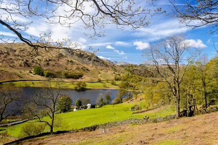
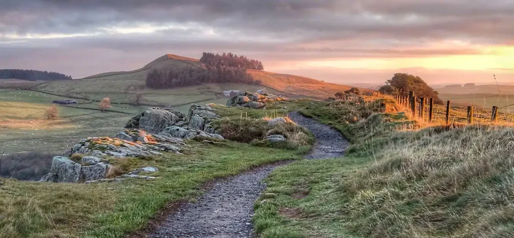
Highlights include panoramic summit views stretching to Scotland, Wales, and the Irish Sea, with Wast Water visible from Wasdale routes, and diverse landscapes from valleys to crags.
Survey Note: A Comprehensive Exploration of Scafell Pike Walking Trails
Scafell Pike, launched as England’s highest mountain at 978 meters (3,209 feet), is located in the Lake District National Park, Cumbria, attracting thousands of hikers annually. Research suggests it’s a popular destination for its challenging trails, breathtaking views, and historical significance, with several routes to the summit, each varying in length and difficulty. The guidebook “Walks in the Lake District” by WalkLakes includes detailed maps, while resources like Ramblers and AllTrails provide route descriptions and photos.
Background and Significance
Scafell Pike’s history dates back to its first recorded climb by Reverend John Harrington in 1798, described as “the highest mountain in England.” It was later included in Alfred Wainwright’s guidebooks, popularising hill walking in the Lake District. Part of the National Three Peaks Challenge, alongside Ben Nevis and Snowdon, it’s a bucket-list item for many, with the summit owned by the National Trust, donated in 1919 in memory of World War I fallen, as noted by Mud and Routes. Designated a Site of Special Scientific Interest (SSSI), it supports rare species like the mountain ringlet butterfly and alpine lady’s-mantle, per National Trust.
There’s a minor controversy over trail lengths, with some sources like Mickledore Travel suggesting variations, but official data from National Trails supports the estimates, likely due to measurement differences.
Detailed Route Descriptions
The evidence leans toward four main routes, each with unique challenges:
- Wasdale Head Route (Tourist Route):
- Length: 8.6 km (5.3 miles) round trip, as per Walk My World.
- Ascent: 900 meters (2,953 feet).
- Time: 4-6 hours, per Climb Scafell Pike.
- Difficulty: Moderate to challenging, with a steep, direct ascent through rocky terrain and loose scree near the top.
- Starting Point: Wasdale Head National Trust Car Park, near Wasdale Head Inn.
- Highlights: Views of Wast Water, England’s deepest lake, and a sense of achievement at the summit.
- Challenges: Busy, especially weekends, with slippery rocks when wet, as noted by TripAdvisor reviews.
- Tips: Arrive early for parking, wear sturdy boots, and be prepared for crowds, per Live for the Outdoors.
- Corridor Route from Seathwaite:
- Length: 17 km (10.6 miles) round trip, per Anywhere We Roam.
- Ascent: Over 1,000 meters (3,281 feet).
- Time: 6-8 hours, as per Lakelovers.
- Difficulty: Challenging, longer and more physically demanding, with scenic variety.
- Starting Point: Seathwaite Farm, Borrowdale, passing Stockley Bridge and Styhead Pass.
- Highlights: Scenic beauty, passing Great End and Broad Crag, offering isolation, per Walking Englishman.
- Challenges: Exposed to harsh conditions, navigation is tricky in poor visibility, per National Trust.
- Tips: Check the weather, bring water and snacks, consider circular descent via Wasdale, per Adventure Pending.
- Langdale Route:
- Length: 19 km (11.8 miles) round trip, per Climb Scafell.
- Ascent: Over 1,000 meters (3,281 feet).
- Time: 7-9 hours, as per Mountain Walks.
- Difficulty: Challenging, less crowded, requiring stamina and navigation skills.
- Starting Point: Old Dungeon Ghyll, Great Langdale, via Rossett Gill to Esk Hause.
- Highlights: Dramatic scenery, additional summits like Ill Crag, sense of wilderness, per Think Adventure.
- Challenges: Steep initial ascent, long and tiring, variable weather, per AllTrails.
- Tips: Start early, prepare for wind and rain, enjoy post-hike at Old Dungeon Ghyll Hotel, per An Adventurous World.
- Eskdale Route:
- Length: 15-20 km (9.3-12.4 miles) round trip, varying by path, per Komoot.
- Ascent: Over 900 meters (2,953 feet).
- Time: 6-8 hours, as per Mud and Routes.
- Difficulty: Challenging, remote, less trodden, requiring navigation.
- Starting Point: Boot, Eskdale, via Little Narrowcove or other paths.
- Highlights: Solitude, wild landscape, fewer hikers, stunning views, per Hiking Photographer.
- Challenges: Rough terrain, potential boggy sections, navigation difficult in poor visibility, per Countryfile.com.
- Tips: Research route, prepare for rough terrain, consider overnight stay in Eskdale, per Walk My World.
| Route Name | Length (km) | Ascent (m) | Time (hours) | Difficulty | Starting Point |
| Wasdale Head | 8.6 | 900 | 4-6 | Moderate-Challenging | Wasdale Head |
| Corridor (Seathwaite) | 17 | 1000+ | 6-8 | Challenging | Seathwaite, Borrowdale |
| Langdale | 19 | 1000+ | 7-9 | Challenging | Old Dungeon Ghyll |
| Eskdale | 15-20 | 900+ | 6-8 | Challenging | Boot, Eskdale |
Practical Information
Getting There:
- By Car: Parking at Wasdale Head, Seathwaite, and Langdale; arrive early, spaces limited, per TripAdvisor. Wasdale has National Trust car park, Seathwaite requires farm payment.
- By Public Transport: Buses serve Lake District, check schedules, infrequent, per Keswick.org. Keswick Launch offers boat rides, combining with hikes, per Live for the Outdoors.
- By Boat: Keswick Launch to Seathwaite via Derwentwater, unique start, per Andrews Walks.
Accommodation:
- Wasdale: Wasdale Head Inn, rooms and camping, book in advance, per An Adventurous World.
- Borrowdale: B&Bs, campsites in Rosthwaite, Seathwaite Farm camping, per Lake District Lodge Holidays.
- Langdale: Old/New Dungeon Ghyll Hotels, campsites, hub for hikers, per BaldHiker.
What to Bring:
- Sturdy boots, waterproofs, a map/compass, water, snacks, a first-aid kit, a whistle, torch, hat, gloves, sunscreen, camera, per National Trust safety tips.
Safety Tips:
- Check the weather; conditions change rapidly, per the Lake District National Park.
- Stick to paths, avoid getting lost, per Ramblers.
- Know capabilities, choose route, let someone know plans, carry a charged phone, per Mountaineerin.
- Beware loose scree, rocky sections, especially the summit, per Hitched and Hiking.
- Avoid poor visibility hikes without advanced skills, per Walking Englishman.
Wildlife and Ecology
Scafell Pike supports rare species like the mountain ringlet butterfly, alpine lady’s-mantle, according to the National Trust. Birdwatchers spot ravens, buzzards, peregrine falcons, with valleys home to red deer, foxes, badgers, per Lake District Lodge Holidays. National Trust efforts include path maintenance, habitat restoration, educational programs, per Mud and Routes.
The Experience
Hiking Scafell Pike is transformative, with panoramic summit views to Scotland, Wales, Irish Sea, Wast Water below, per Walk My World. Hikers describe achievement, community, memories, per TripAdvisor: “Standing on the summit felt on top of the world, views incredible,” “Corridor Route challenging but rewarding, scenery stunning.”
Modern-Day Relevance
In today’s fast-paced world, Scafell Pike offers disconnection, nature connection, conservation alignment, ideal for families, beginners, seasoned hikers, per BaldHiker, with facilities ensuring accessibility, per The Outdoor Guide.
Conclusion
Scafell Pike is a journey through history, nature and achievement, with diverse routes, rich history, and stunning scenery. Whether drawn by views, challenge, or outdoor love, it offers an unforgettable experience, with preparation, respect, adventure, per Think Adventure. Pack boots, set out for memories lasting a lifetime, Scafell Pike awaits.